



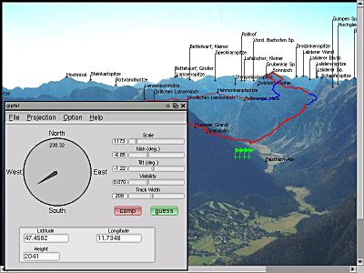
from the gipfel’s website:
gipfel helps to find the names of mountains or points of interest on a picture. It uses a database containing names and GPS data. With the given viewpoint (the point from which the picture was taken) and two known mountains on the picture, gipfel can compute all parameters needed to compute the positions of other mountains on the picture. [...] You can think of gipfel as a georeferencing software for arbitrary images (not only satelite images or maps). gipfel also has an image stitching mode, which allows to generate panorama images from multiple images that have been referenced with gipfel .
To get the idea, firefox or konqueror users can point their browsers here. The hotspots on the image appears when you move the mouse over it. Please scroll to the right-hand part of the image as all the linked elements are concentrated in this area.
