




Haïti and the importance of open maps.
2010-02-08 11:30:32 - by
Nicolas Malevé
A bit after the fact, but still very interesting information. How Openstreetmap has been used to help NGO’s work in Haiti after the earthquake. A specific webpage has been set up for the occasion: http://www.openstreetmap.org.ph/
A thorough article by Camille Gévaudan, in ecrans.fr (in French).
Other informations in opensource.com
Quick selection of images:
– Map showing the depth of flooding, using OSM road data.

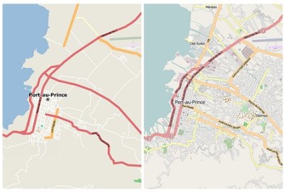
– Port au Prince before and After
Project report "Busboîtescartesmaps"
2009-10-25 17:49:23 - by
Nicolas Malevé
More than time for a project report on Busboîtescartesmaps project that took place last November.
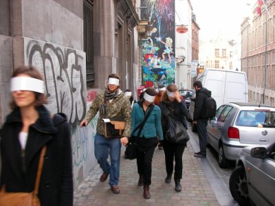
The project proposed to the participants to drift within Brussels using the post boxes as elements to create their itinerary. The walks were conducted by several guides (Peter Westenberg, Christina Clar and Natasha Roublov, Lottie Child) who imagined different experiments to understand space and urbanism differently.
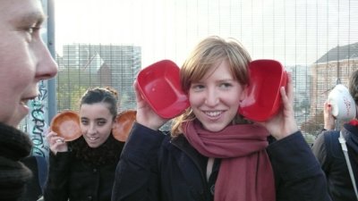
This project was the occasion to make a first software prototype, using the Tresor’s toolbox, to record the meanderings of people in the city.
Here follows a series of notes explaining the first steps of the project.
The scenario goes like this. We select a series of spots in Brussels. These spots correspond to the postboxes spread in the center of the city. Their locations cover a wide range of places and environments, you can find them near schools, streets with heavy traffic, dead end streets, parks, etc.
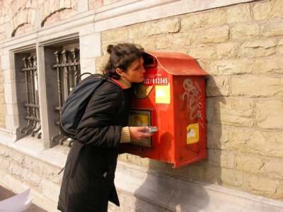
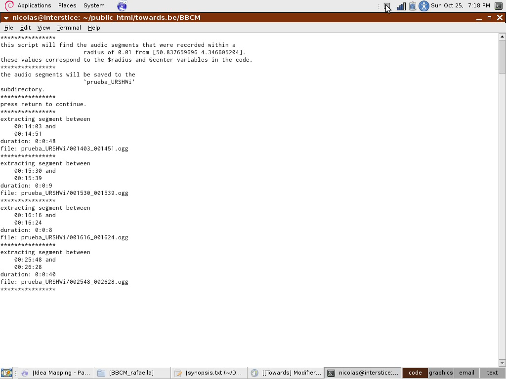
A group of people go in the city with an audio recorder and a GPS and visit the spots. The clocks of the GPS and the recorders are synchronised. The GPS records all the time the tracklogs of the people and the audio device capture the sound for the whole duration of the walk. When they come back after the walk, the GPS data and the audio data are copied on a computer. By comparing the time code of the GPS track and the start time of the audio track, we can extract audio segments based on location. we can extract the audio recorded by the walkers when they were nearby the spots.
These audio segments can then be placed on a digital map where the visitors can listen to them. The interface allow them listen to the chaos of all the sounds they have recorded near the spots or to select the sounds one by one, turn them on and off.
Samples:
Some walks have concentrated on the atmospheric sound, recording the ambient atmosphere( ie. pool_atmosphere_long.ogg), or interacting with it (scratching the surface with shoes ie. scratching_the_ground.ogg).
Other guides gave instructions like describing aloud what one was seeing (STE-003-workingcopy_00m_43s_40h__01m_25s_90h.mp3, STE-003-workingcopy_35m_43s__38m_59s_40h.mp3, STE-003-workingcopy_09m_01s_80h__10m_37s_60h.mp3, STE-003-workingcopy_51m_30s__55m_28s_60h.mp3,STE-003-workingcopy_15m_55s_50h__19m_37s.mp3,STE-003-workingcopy_23m_17s_40h__27m_52s_90h.mp3)
Etc etc.
Interface:
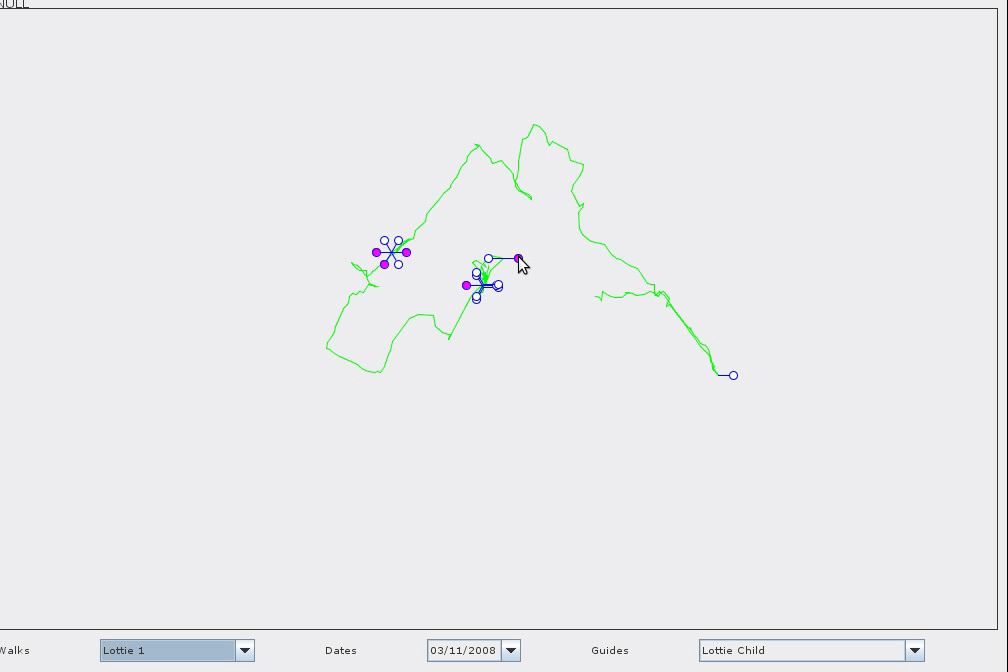
By default, the software lets you listen to the ’mumbling’(all_walk-5.ogg,all_walk-0.ogg) of the whole last walk, or to select individual takes within this.
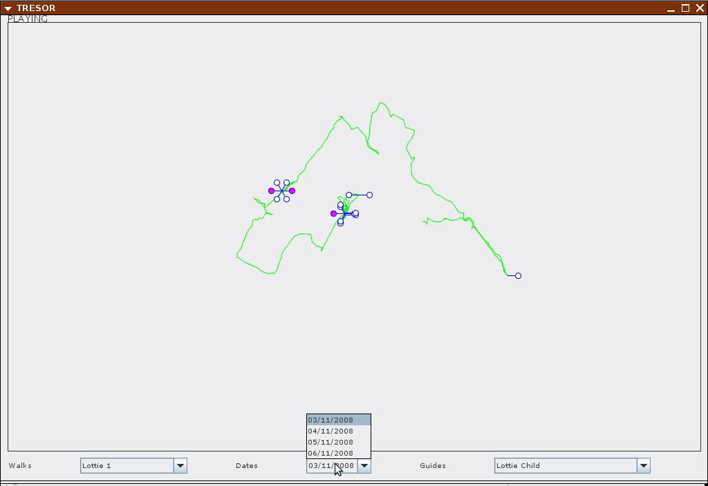
Using the menu, you can chose a walk or chose a date or a guide.
Software in use:
openstreetmap, setting the coordinates
gpsbabel, can extract data from a gps unit. can also select data by region and time
sox, given a start time, it can cut audio fragments for a certain duration
mp3splt, cuts an mp3 file in segments
gstreamer allows for playing audio files concurrently
perl, php and java to glue the elements.
The software prototype has been developed by Ivan Monroy Lopez and Nicolas Maleve. The pre-alpha soon available for download.
Urban Versioning System v1.0
2009-08-11 15:45:13 - by
Nicolas Malevé
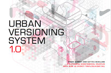
A quasi-license by Matthew Fuller and Usman Haque.
PreambleTake the separate domains of Free Software licenses and of spatial construction. Consider each of them as a series of types of entity, composition and relations. What series might be invented to run across the two of them? This document is a quasi-license. If its constraints are followed in the production of spatial structures, whether buildings or more fleeting constructions, you, and others, will be able to make something new, or reversion something already there and you will be able to express clearly how others can participate or make use of the work you are creating.
The production of structures to articulate, produce and protect space, often coded under the disciplinary term ‘architecture’ is arguably one of humanity’s oldest activities. Countless technologies and legal frameworks have grown along with this process. Formerly one of the most collaborative endeavours, architecture now often functions in opposition to such collaboration. On the one hand it reinforces, and is reinforced by, whatever accretes as the currently dominant political system and some contend that this relationship makes it ineligible as a means for authentically confronting structures of power.i On the other, making buildings is a substantially collaborative effort, always involving teams and multiple kinds of expertise and decision making. All that may be required to free up construction is to render its repertoire of collaboration more expansive. Recent social, cultural and technological developments, particularly in the fields of software and electronics, suggest strategies for productive mechanisms that exist substantially within a given political frameworkyet still are able to provide clear indication of political alternatives. These alternatives in software, Free, Libre and Open Source Software (FLOSS) are highly pragmatic, do the work required of them but also reinvent forms of production in a way that set up real possibilities for freedom.
Why is this relevant to the making of urban spaces? For the first time in the history of humanity more of us live within cities than outside them.ii It is vital to begin to think through how we can become more consciously involved in their design, production and inhabitation. While there is a concern about how much individuals can, with good purpose, affect their environment it is clear that we are all, collectively, and in ways strongly shaped by the kinds of collectives we form, having some sort of ecological impact. Therefore ways of organising frameworks, in formal or less formal ways, for collectively productive activities are becoming increasingly important to attend to. A discussion of the processes through which humans construct cities could appear to support the argument that there is a distinction between “artificial” and “natural”. In fact it demonstrates the opposite: just as with any non-human entity we collectively construct our ecological and architectural frameworks and these frameworks tend to overlap with those of others. These overlaos have consequences. The difference is (or should be) that we consciously recognise our interdependence and thus must consciously act upon it.
Architecture, which exists at the very moment when space is defined, constructed and experienced through activity, is perhaps the most common shared enterprise of them all. A city is a city if it is lived-in: otherwise it is merely a pile of bricks, cables and concrete. Our interdependence however does not mean that anyone is ‘naturally’ dependent on the current state of cities or societies. The proportion of the earth’s inhabitants ‘depending’ on systems of neo-liberalism or oligarchy, for instance, are rather pitiful compared to the amount of natural and human resources they require to maintain their unabashedly vampiric positions. Such a situation deserves some regeneration.
In order to develop thinking about such interdependence and collaboration we might as well start from where it is blocked. The architectural profession remains relatively steadfast in a distinction that divides designers from users, even though technology increasingly provides grounds for diminishing that distinction, either through networks (electronic, social, geographical) that provide people with better access to cross-collaborative tools and multi-disciplinary inputs or through responsive building technologies that can place people themselves at the helm of the configuration/design of their own spaces.
In the eighties and nineties, computers’ impact on the architectural discipline was in the form of design aids. In the coming decades computers will increasingly be a part of the architecture itself, enabling user-centered interaction systems for configuring environmental conditions. We have already seen systems like those that track movements of the sun to control louvres outside a building, or movements of people to adapt light levels inside a building. We have seen “intelligent” devices that monitor temperature to provide us with optimum levels or even walls that change colour as necessary to complement interior designs. However, innovation in the design and construction of the built environment of the future, appears to be split problematically between large developers (who have their own particular efficiencies of scale to optimise) on one hand, and ubiquitous computing technologists (who are developing the systems that mediate the ways that we relate to our spaces and to each other) on the other, with architects finding themselves somewhat irrelevant. People-centered architectural interfaces and responsive building systems are being developed, not by architects but by computer scientists designers and artists working independently or through numerous institutions, with all the historical and commercial associations that these institutions are party to. .
This document proposes that another lesson can be learned for architecture from computing: the way in which software is made. Here, we want to concentrate on the current most significant mode of software development, Free, Libre and Open Source Software (FLOSS), steering clear of ubicomp fantasies that may often obfuscate technological power structures.
Gender Art Net
2009-05-12 16:21:04 - by
Antoine Berlon
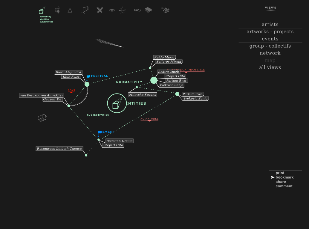
OSP participe actuellement au développement du projet Gender Art Net.
Gender Art Net propose de créer un atlas interactif donnant accès à différentes vues et lectures d’un ensemble de positions artistiques feministes dans l’Europe contemporaine.
Soutenu par l’European Cultural Foundation le projet est conçu par la productrice et commissaire Bettina Knaup, en collaboration avec Constant vzw. L’équipe du projet se compose de curatrices, artistes, statisticienne, développeurs, de Berlin, Barcelone, Amsterdam (Dunja Kukovec, Laurence Rassel, Diana McCarty, Maria Perez, Katalin Timar, Urska Merc) et d’étudiants le la section European Media Studies de l’Université de Postdam (Lenore Hipper, Inés Matres, Sebastian Moering, Laura-Helen Rüge)
Le projet explore les relations entre genres, territoires, artistes, œuvres, groupes, réseaux et événements à travers différentes thématiques / fils de discussions.
La base de données du projet se nourrit d’informations encodées par l’équipe éditoriale et d’informations extraites dynamiquement sur les sites web représentatifs des artistes.
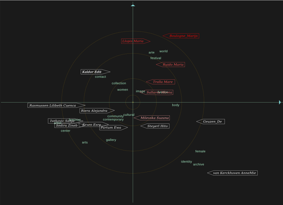
OSP travaille à rendre visibles, dynamiques et interactifs ces différents niveaux d’informations.
En collaborations avec Anne-Laure Buisson (statistician, feminist activist, Brussels), nous cherchons à distribuer/spacialiser un ensemble de mots clés significatifs en relation avec les artistes.
Les mots extraits des sites sont filtrés via des techniques de statistiques multi-variées pour générer des représentation en deux dimension reprenant les mots et les artistes, indiquant les relations entre eux et les particularités du lexique et des centres d’intérêts des artistes. Une série de graphiques, agissants comme des clichés ou petites cartes thématiques de l’atlas sont ainsi obtenus.
Plus d’informations Ici
Les informations encodées par l’équipe éditoriale localisent les lieux d’origine et de travail des artistes, associent les artistes à des fils de discussion et réseaux, et relient des œuvres/projets à des lieux.
OSP développe une interface qui permettra de parcourir en ligne cette carte feministe du ciel artistique européen.
Wikibivouac
2009-05-08 13:39:01 - by
Antoine Berlon
Wikibivouac is a collaborative map which reappropriates space to create new uses of the city.
The wiki element of contibutions from anyone aggregates information for improved transient occupancy of place.
To do this, the ZOOM team initiated the Hunting Days sessions, worldwide searches for locations of a particular resource - free, drinkable water points, one of the most critical resources to human existence. The first step was a venture into the streets Madrid in search of a free source of potable water. Discovering a fountain in the park, team members shot video to illustrate the potential uses of the resource, integrating the secnes into an instructional video introduceding the hunt and demonstrating the use of the interface to enter the points by street address or GPS coordinates. Data fields provided a way for hunters to enter info about the point, the way to access it, the times it is available, and other descriptive information. By the end of the first Hunting Day, (57) free drinkable water points had been entered into the database, and appeared in the worldwide map, with concentrations in Paris and Prague. When clicked, the points displayed the desciptive information which hunters had entered.
With the first hunt complete, focus shifted to the development of the openlayer tool which drives the Wikibivouac. Some points displayed at inaccurate locations. Developer Sami improved the accuracy of point placement from the interface, also creating a custom blue icon to represent water point locations. The points were shown by default on a black screen, but if users clicked the small plus-sign in the upper right corner, a small menu appeared which gave the option of viewing the points on two different map views.
After selecting the theme of the second hunt, a second instructional video was produced, keeping a humorous tone to encourage hunters to search for free warm spots where one can find shelter through the night. Again the object of the hunt was a free, available, underused resource important to human survival. The Wikibivouac collaborators await the results of the next hunt, which begins tomorrow.
See the site :http://www.wikibivouac.org/
Meipi-espaces collaboratifs
2009-05-06 16:46:14 - by
Antoine Berlon
Meipi est une plateforme collaborative qui permet aux utilisateurs de publier des informations et des contenus sur un plan de ville. Les meipis choisis se réfère à un contexte spécifique. Celui-ci peut être local s’il représente une entrée sur un lieu donné ( un meipi de Grenoble par exemple) ou thématique s’il correspond à des sujets précis ( un meipi des villes belges).
Un meipi permet donc à une communauté d’utilisateurs de rassembler l’information concernant un endroit, une thématique et ainsi constituer une base de données collaborative.
4816
2009-03-09 23:46:01 - by
Nicolas Malevé
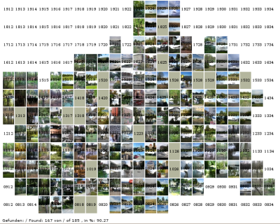
« 4816 is about finding the minute points on the GPS grid in the urban area of Vienna.
The point N 48° 11,000´ E 16° 19,000´ is an example of these 185 intersections
of latitudinal and longitudinal minutes within Vienna. The intercept points are about
1.9 km apart on the north-south axis and about 1.25 km apart on the east-west axis.
The goal with 4816 is to find those intercepts with the support of the GPS tool and
document them photographically. At each intercept point a photo is taken in each
compass direction.
By traversing the GPS intercept points you take a journey through Vienna. The goal is
known. But what will be the nature of its environment? Will it be approachable? What
will be the special thing about it? It will be a interesting process to observe how
long it will take untill all 4816-points are found. A significant number of points
will be in buildings. A few will be in the middle of the Danube. These are two of the
difficulties we have encountered. It remains to be seen which ones await us.»
Busboîtescartesmaps
2008-10-28 16:34:48 - by
Nicolas Malevé
Post boxes are a familiar repetitive phenomenon in the urban landscape. Even when postoffices become privatized and disappear, these boxes remain firmly planted in the urban soil. Busboîtescartesmaps invites us to validate these entities as more than just utilitarian tools. Drifting from one box to another, the walks propose to climb them, to explore their musical qualities, to listen to the stories that echo from their interiors. Among other things the walks contribute to a collective mapping in which the trace of one walk echoes the existence of other walks. You can participate in the walks starting from Recyclart, where also the communal map can be consulted, and also the Atlas of subjective and collaborative maps of Brussels.
Postbussen zijn een bekend wederkerig aspect van het urbane lanschap. Zelfs nu posterijen en agentschappen geprivatiseerd worden en langzamerhand steeds meer verdwijnen, blijven de bussen ferm gewordteld in de stadse aarde.
Busboîtescartesmaps nodigt ons uit om de bussen te herwaarderen als meer dan enkel nuttige gereedschappen. De wandelingen onderzoeken de bussen als potentiele muziekinstrumenten, als stadselementen die beklommen,kunnen worden en als dragers van verhalen en herinneringen. De wandelingen dragen bij aan een collectieve audio-mapping die de verschillende onderwerpen van de wanddelingen met elkaar verbindt. Je kunt meewandelen vanaf Recyclart, waar ook de gemeenschappelijke kaart kan worden bekeken / beluisterd, samen met de Atlas van subjectieve kaarten van Brussel.
Les boîtes postales implantées dans le paysage bruxellois sont des points de repère familiers. Si les bureaux de poste disparaissent graduellement avec la privatisation, les boîtes, elles, résistent et jalonnent le territoire. Busboîtescartesmaps est une invitation à prendre ces boîtes pour plus que de simples conteneurs utiles. En dérivant de l’une à l’autre, les différentes ballades proposées en feront des montagnes à escalader, des instruments sonores ou des antennes déclencheuses d’histoires et de narrations. Ces ballades feront en outre l’objet d’une mise en carte commune où chaque trajet pourra faire écho à un autre. On pourra participer à cette cartographie en partant de Recyclart, qui abritera aussi la carte commune ainsi qu’un espace de consultation dédié à un Atlas des cartes subjectives et collaboratives de Bruxelles.
Busboîtescartesmaps
2008-10-20 11:34:51 - by
Nicolas Malevé
Busboîtescartesmaps is een evenement in het raamwerk van het Towards project
dat subjectieve representaties van het Brusselse terrein combineert met het ontwikkelen van een software voor subjectieve cartografie. Mede geinspireerd door de ervaringen van de serie Routes + Routines exploratieve en perfomatieve wandelingen die ons naar onverwachte hoeken van de Brusselse regio meeneemt.
Postbussen zijn een bekend wederkerig aspect van het urbane lanschap. Zelfs nu posterijen en agentschappen geprivatiseerd worden en langzamerhand steeds meer verdwijnen, blijven de bussen ferm gewordteld in de stadse aarde.
Busboîtescartesmaps nodigt ons uit om de bussen te herwaarderen als meer dan enkel nuttige gereedschappen. De wandelingen onderzoeken de bussen als potentiele muziekinstrumenten, als stadselementen die beklommen,kunnen worden en als dragers van verhalen en herinneringen.
De wandelingen dragen bij aan een collectieve audio-mapping die de verschillende onderwerpen van de wanddelingen met elkaar verbindt. Je kunt meewandelen vanaf Recyclart, waar ook de gemeenschappelijke kaart kan worden bekeken / beluisterd, samen met de Atlas van subjectieve kaarten van Brussel.
Uw gidsen :
Peter Westenberg is beeldend kunstenaar, videomaker en lid van Constant. Zijn werk onderzoekt sociale cartografieen, urbane anomalieen en de complexe relatie tussen identiteit en geografische specficiteit.
Christina Clar en Natasha Roublov zijn kunstenaars gebaseerd in Brussel die zich bezig houden met performance, installaties en urbane interventies die focussen op de knooppunten tussen geluid, visuele cultuur en architectuur.
Lottie Child is een Engelse kunstenares die Street Training Manuals produceert voor speelse / antisocialeinteractie met urbane plaatsen die expertise en kennis uitwisselen rondom noties als veiligheid en plezier in een toenemend gesanitiseerde en gecontroleerde omgeving.
"In Brussels I will engage with interested people to create a StreetTraining circuit featuring the joyful behaviours Belgian street users employ and those we innovate together during an initial session."
Busboîtescartesmapsis een project van Constant in samenwerking met Recyclart en Speculoos, Jeugd en Stad, Yota! en Beam, en met Rafaella Houlstan-Hasaerts.
Tijden van de wandelingen
Twee wandelingen per dag, met een maximum van 10 deelnemers per wandeling op 4, 5 en 6 november.
Vertrektijden: 14:00 en 17:00, startpunt Recyclart
Het kaartenproject l’Atlas zal getoond worden dagelijks van 14:00 tot 18:00 in Recyclart
Meer informatie over het project:
http://www.towards.be/busboitescartesmaps
Busboîtescartesmaps
2008-10-20 11:33:03 - by
Nicolas Malevé
Busboîtescartesmaps est un événement qui a lieu dans le cadre du projet
Towards, une tentative de représentations subjectives du territoire de
Bruxelles couplée à la création d’un outil collaboratif de cartographie.
Il est aussi inspiré par les expériences réalisées dans le cadre de Routes
And Routines, série de promenades urbaines, de ballades performatives et
de visites surprise qui nous emmènent dans des endroits inattendus de la
région de Bruxelles.
Les boîtes postales implantées dans le paysage bruxellois sont des points
de repère familiers. Si les bureaux de poste disparaissent graduellement
avec la privatisation, les boîtes, elles, résistent et jalonnent le
territoire. Busboîtescartesmaps est une invitation à prendre ces boîtes
pour plus que de simples conteneurs utiles. En dérivant de
l’une à l’autre, les différentes ballades proposées en feront des
montagnes à escalader, des instruments sonores ou des antennes
déclencheuses d’histoires et de narrations. Ces ballades feront en outre
l’objet d’une mise en carte commune où chaque trajet pourra faire écho à
un autre. On pourra participer à cette cartographie en partant de
Recyclart, qui abritera aussi la carte commune ainsi qu’un espace de
consultation dédié à un Atlas des cartes subjectives et collaboratives de
Bruxelles.
Vos guides :
Peter Westenberg est artiste visuel, réalisateur de vidéos et de
court-métrages et membre de Constant. Il s’intéresse à la cartographie
sociale, aux anomalies urbaines, aux identités multiples et aux tensions
entre le rêve et la réalité. Son travail a été montré lors d’expositions
et de festivals tels que le Portobello Filmfestival de Londres, Impakt
Utrecht, le Festival Argos Brussel, le Festival International du film de
Rotterdam et Videoex à Zürich.
Christina Clar et Natasha Roublov sont des artistes basées à Bruxelles. Le
travail de Christina se situe et bouge constamment entre la
performance, les événements, les installations, les interventions urbaines
et les applications qui intègrent les possibilités de l’ordinateur. Elle
construit des espaces qui estompent les limites entre les espaces projetés
dans l’esprit et les espaces ’réels’, avec du son et des images, en
utilisant l’architecture, l’intervention physique, la poésie et les media.
Natasha est architecte et designer de formation et a co-fondé le collectif
Ici-même (www.icimeme.info) à Paris où ses membres réalisent des surprises
urbaines en se réappropriant les éléments du paysage pour questionner
notre condition urbaine dans les villes contemporaines. Elle développe en
parallèle un travail plus sculptural fait d’interventions éphémères en
taille réelle. Ensemble, les deux artistes ont investi l’architecture
temporaire de Rotor à la rue de Flandre en 2007.
"Comment écouter la ville ? Comment l’entendre ? en cherchant une vision
spécifique via la marche et l’écoute, en travaillant les positions que
l’on prend lorsqu’on observe et écoute dans l’espace urbain."
Lottie Child est une artiste anglaise qui produit des manuels
d’entrainement de rue. Ceux-ci invitent à s’engager dans l’espace public
pour échanger de l’expertise et du savoir sur les notions de sécurité et
de plaisir dans un environnement urbain de plus en plus sanitaire et
contrôlé. Sa recherche se définit par la déambulation, le dialogue et la
réflexion ; et ses interventions peuvent amener à escalader, pénétrer dans,
jouer avec, renforcer et/ou pisser sur les obstacles rencontrés - qu’ils
soient physiques, mentaux ou sociaux. Cette méthodologie a été utilisée
lors de l’exposition Games and Theory à la South London Gallery, lors de
l’exposition personnelle Guide to Risk à l’arttransponder Berlin, et dans
des commissions en cours qui émanent du Kunstraum Linz et de la Pinakothek
Der Moderne Munich.
"A Bruxelles, je me lancerai avec les gens intéressés dans la création
d’un circuit d’entraînement de rue qui intègrera les comportements joyeux
des utilisateurs de la rue belge et ceux que nous inventerons lors d’une
session initiale."
Busboîtescartesmaps est un projet de l’asbl Constant en collaboration avec
Recyclart et Speculoos, Jeugd en Stad, Yota ! et Beam. Ainsi qu’avec la
participation de Rafaella Houlstan-Hasaerts.
Horaire des ballades :
Deux promenades par jour avec un maximum de 10
participants par ballade du 4 au 6 novembre inclus.
Départs à 14 heures et 17 heures.
La carte commune et l’Atlas seront accessibles de 14 à 18 heures à Recyclart
Plus d’informations sur le projet à :
http://www.towards.be/busboitescartesmaps.
Vous pouvez visionner la vidéo des ballades en cliquant sur ce lien http://video.constantvzw.org/busboite/
Busboîtescartesmaps
2008-10-20 11:31:05 - by
Nicolas Malevé
Busboîtescartesmaps is an event in the framework of the Towards project that combines subjective representations of the Brussels’ terrain which the development of a software for subjective cartography. Also inspired by the experiences springing from the Routes + Routines series of explorative performative walks, that take us to unexpected corners of the Brussels region.
Post boxes are a familier repetitive phenomenon in the urban landscape. Even when postoffices become privatised and disappear, these boxes remain firmly planted in the urban soil. Busboîtescartesmaps invites us to validate these entities as more than just utilitarian tools. Drifting from one box to another, the walks propose to climb them, to explore their musical qualities, to listen to the stories that echoe from their interiors.
Among other things the walks contribute to a collective mapping in which the trace of one walk echoes the existence of other walks. You can participate in the walks starting from Recyclart, where also the communal map can be consulted, and also the Atlas of subjective and collaborative maps of Brussels.
Your guides :
Peter Westenberg is visual artist, videomaker and member of Constant. He works onsocial cartographies, urban anomalies and complexity of identity and geography.
Christina Clar and Natasha Roublov are artists based in Brussels, moving between performance, events, installations and urban interventions focussing on the meeting points between sound, visuals and architecture.
Lottie Child is a British artist who produces Street Training Manuals for playful/antisocial engagement with urban places exchanging expertise and knowledge on the notions of safety and joy in increasingly sanitized and controlled urban places. Research is wandering, talking, thinking; and intervention might include climbing, penetrating, playing with, nurturing, and/or pissing on encountered boundaries - physical, mental and social. "In Brussels I will engage with interested people to create a StreetTraining circuit featuring the joyful behaviours Belgian street users employ and those we innovate together during an initial session."
Busboîtescartesmaps est a project of the association Constant in collaboration with
Recyclart and Speculoos, Jeugd en Stad, Yota! and Beam. Also with the participation of Rafaella Houlstan-Hasaerts.
Hours of the walks
Two walks per day, with a aximum of 10 participants per walk on 4, 5 and 6 november.
Departures at 14:00 and 17:00, starting paoint Recyclart
The communal carts of l’Atlas are on show from 14:00 to 18:00 at Recyclart
More information on the project:
http://www.towards.be/busboitescartesmaps
More than the sum of the parts
2008-09-10 11:47:14 - by
Nicolas Malevé
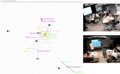
In his PhD’s dissertation, Ben Shaw discusses «how shared representations enhance design collaboration. I draw on examples from my field study at NASA’s Jet Propulsion Laboratory, where real-time teams have radically accelerated the design of next generation exploratory spacecraft and science missions to Mars. My results highlight the roles representations play in generating possibilities, synthesizing perspectives and consolidating commitment to action, thereby helping collaborative groups bring about preferred futures.»
For his dissertation he created a few network animations of the Nasa designers team meetings.
«The behavior of these networks reflects important aspects of the interaction taking place in a design meeting at any given time, including the level of support and commitment expressed for different proposals, the extent to which participants engage one another’s points of view, and the degree of integration of shared representations in conversation. This behavior can be visualized using animated layout diagrams such as those below (produced with a program called SoNIA and viewed in Quicktime movies). The qualitative information conveyed by these diagrams can be complemented by applying numerical metrics to the network structures, as described in the dissertation.»
Mapping Me / Mapping You
2008-04-06 19:44:14 - by
Nicolas Malevé
April 25, 18:00 - 20:00, in Recyclart
A roundtable meeting about cartography between An Mertens (and other members of
Saturdays, Woman and Free Software)
, Liesbeth Huybrechts (Cultural studies PHD KuLeuven, researcher, curator),
Nicolas Malevé (Tresor software, Towards.be) and
Peter Westenberg (Routes + Routines) investigating GEO data control, different layers
and perspectives on the art of mapping, subjective cartographic perception and /Home as private territory.
- w h e n : April 25, 18:00 - 20:00
- l o c a t i o n : Recyclart, GARE BRUXELLES-CHAPELLE, Rue des Ursulines 25, Brussels
OpenStreetMap de Bruxelles
2008-02-28 12:41:50 - by
Rafaella Houlstan-Hasaerts
Anonymes (une initiative de l’OpenStreetMap foundation), 2004- ?
La fondation OpenStreet map est une association sans but lucratif de portée internationale, dont le but est d’encourager la croissance, le développement et la distribution de données géographiques libres et de permettre à tout un chacun d’utiliser et de partager des données géospatiales. Le projet a débuté car la plupart des cartes qui semblent gratuites au premier abord possèdent en réalité des restrictions légales ou techniques limitant leur usage et empêchant de leur utilisation créative, productive ou inattendue. Les personnes qui désirent contribuer au projet emportent leurs GPS portables en voyage ou sortent spécialement pour enregistrer des traces GPS. Ils enregistrent des noms de rues et de villages et toutes autres caractéristiques en utilisant un carnet, un appareil photo ou un dictaphone. De retour devant leur ordinateur, les contributeurs téléchargent les traces GPS indiquant leur trajet et dessinent les routes sur la base de données collaborative d’OpenStreetMap. En utilisant leurs notes, ils ajoutent les noms des rues, des informations sur le type de route ou de chemin et les connections entre les routes. Les données sont alors traitées pour produire des cartes détaillées, qui peuvent être publiées librement sur des sites tels Wikipedia, utilisées pour créer des systèmes de navigation portatifs ou embarqués ou imprimées et copiées sans restrictions.
Exxon secrets
2008-01-17 20:43:34 - by
Nicolas Malevé
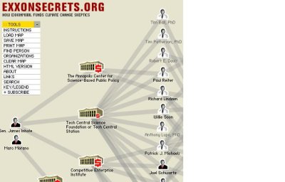
Exxon secrets is a project by Greenpeace that documents Exxon-Mobil’s funding of climate change skeptics. It displays a network graph connecting the different organizations that receive funding from Exxon-Mobil and their spokespeople.
Open StreetMap, Brussels, at Actic 06-01-08
2008-01-09 19:21:30 - by
Nicolas Malevé
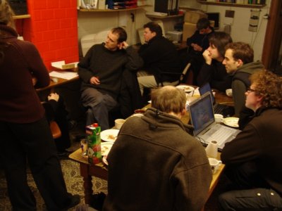
A quick dump of links collected for the Openstreetmap meeting at Actic this Sunday.
openstreetmap:
http://www.openstreetmap.org/
opengeodata:
http://www.opengeodata.org/
AND gives data to Open StreetMap:
http://www.opengeodata.org/?p=223
Potential_Datasources:
http://wiki.openstreetmap.org/index.php/Potential_Datasources
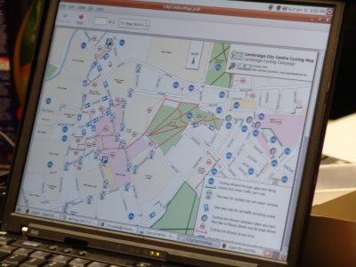
Example of recycling openstreetmap data:
http://www.camcycle.org.uk/resources/citycentre/
Tools:
http://blog.johnmckerrell.com/2007/12/...
Belgium:
http://wiki.openstreetmap.org/index.php/Belgium
osmarender:
http://wiki.openstreetmap.org/index.php/Osmarender
http://wiki.openstreetmap.org/index.php/Osmarender/Howto
josm:
http://www.towards.be/wiki/doku.php
outputs:
http://wiki.openstreetmap.org/index.php/Category:Outputs
source:
software:
http://svn.openstreetmap.org/
data:
http://wiki.openstreetmap.org/index.php/Planet.osm
using:
http://wiki.openstreetmap.org/index.php/Using_OpenStreetMap
Meet Frida V
2007-10-06 15:30:43 - by
Nicolas Malevé
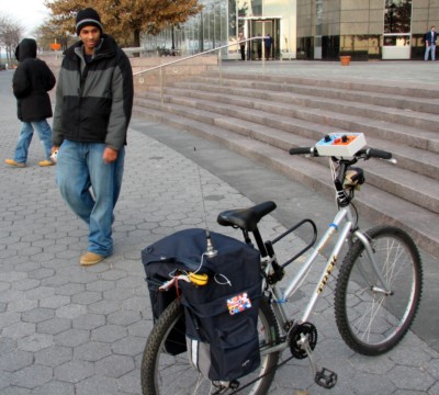
Frida V. is a rugged and comfortable bicycle equipped for efficient exploration and mapping of public urban spaces. It carries a small computer, GPS positioning device, 802.11 wireless network transciever and a basic audiovisual recording unit. The consolidated software and hardware assembly enables automated mapping of stumbled wireless networks, easy creation of location-tagged media and opportunistic synchronization with a server resource on the internet. In other words, let the warriding and rideblogging begin!
Read more orwatch the video (you will need thevlc player)
Thanks Wendy!
OSM Party Brussel
2007-09-13 10:57:13 - by
Nicolas Malevé
16/09/2007: Open Street Map Party Brussel_ Brussel.
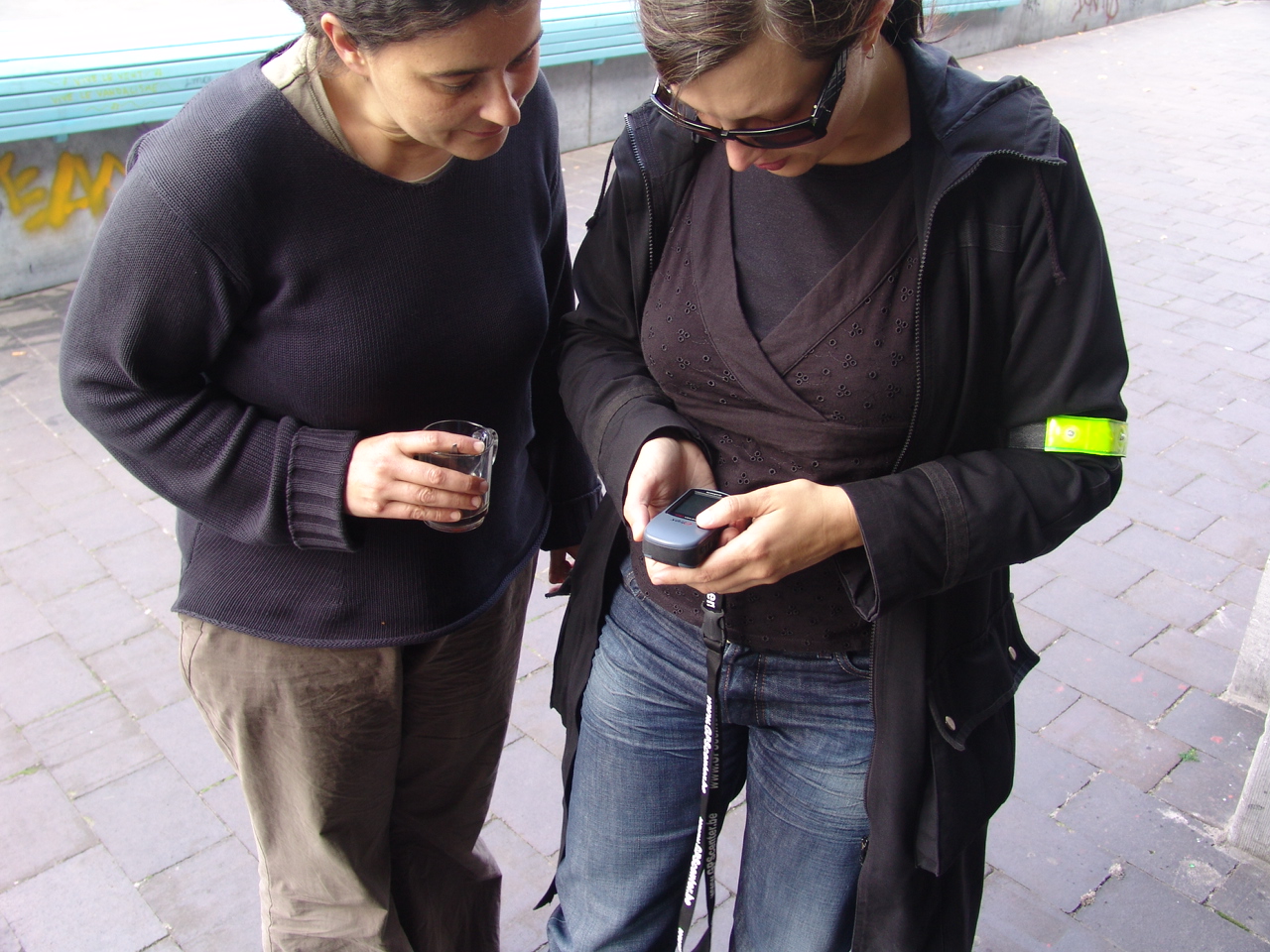
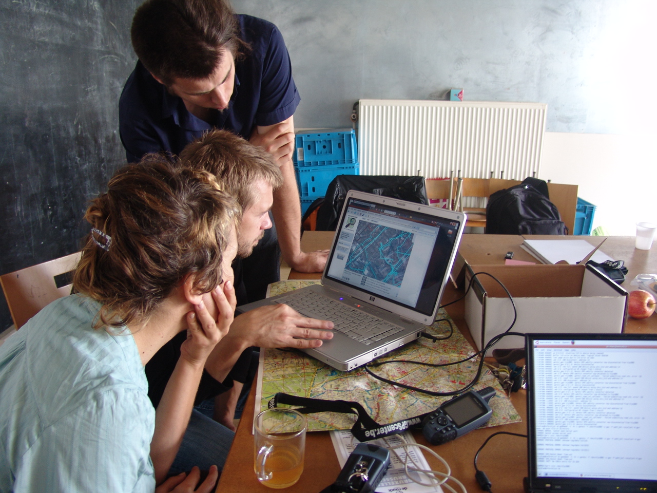
Op zondag 16 september organiseert Constant een Open Streetmap evenement.
We verzamelen GPS tracks in Brussel en voegen die toe aan de database van
Openstreetmap.org. Iedereen is van harte welkom om mee te fietsen en mee
te helpen de tracks te uploaden en annoteren. Het doel is om de gehele
vijfhoek van Brussel te traceren en in kaart te brengen. We zorgen voor
koffie, thee en een warme uitvalsbasis.
Heb je een fiets? neem hem mee !
Heb je een GPS? neem hem mee !
Als je geen fiets of GPS hebt, maar je zou er graag een willen gebruiken,
geef ons dan een seintje:
Constant heeft 6 GPS apparaten te leen en fietsen kunnen we regelen.
Onmoetingspunt:
-------------------
Zondag 16 september, 11:00
RECYCLART
Station Brussel-Kapellekerk
Ursulinestraat 25
1000 Brussel
Ons contacteren:
-------------------
Constant
Fortstraat 5,
1060 St. Gillis
Brussel
T / F: + 32 2 539 2467
E: osmap at constantvzw.com
******************************************************
Wat is OSM ?
-------------------
OpenStreetMap (http://wiki.openstreetmap.org) is een Vrije kaart van de
wereld, die wordt gemaakt door mensen zoals jij. Het OpenStreetMap project
maakt vrije geografische data zoals straatkaarten beschikbaar voor
iedereen. Het project is opgestart om een alternatief te bieden voor dure
commerciële kaarten met restrictieve licenties.
Waarom OSM ?
-------------------
Geografische informatie (geodata) is in grote delen van de wereld, zoals
Nederland en grote delen van Europa, niet vrij beschikbaar. Over het
algemeen zijn overheidsdiensten belast met het in kaart brengen van het
land en die diensten verdienen geld door de informatie te verkopen aan
belangstellenden.
Door de snelle technische ontwikkelingen zijn er nu goedkope
GPS-ontvangers en kan je, in samenwerking met anderen, je eigen kaarten
maken zonder alle genoemde beperkingen. Dankzij deze mogelijkheden winnen
we weer wat terug voor onze samenleving!
Meer vragen?
-------------------
check de FAQ op de Open StreetMap wiki
http://wiki.openstreetmap.org/index.php/Nl:FAQ#Waarom_maken_jullie_OpenStreetMap.3F
OSM Party Brussels
2007-09-13 10:53:21 - by
Nicolas Malevé
16/09/2007_ Brussels.
The aim of this day was to collect GPS tracks of Brussels and to add them to the database of openstreetmap.org., an interface that produces detailed maps that can be freely published, used to create portable navigation systems, carted away or printed and copied without any restrictions. The participants covered therefore the streets of the Pentagon in order to record these GPS tracks and helped to download them on the OSM server.
Organizers:
– Constant
******************************************************
What is OSM?
-------------------
OpenStreetMap (http://wiki.openstreetmap.org) is a Free map of the world,
made by people like you and me. "OpenStreetMap is a project aimed squarely
at creating and providing free geographical data such as street maps to
anyone who wants them."
Why OSM?
-------------------
"The project was started because most maps you think of as free actually
have legal or technical restrictions on their use, holding back people
from using them in creative, productive or unexpected ways."
How does it work?
-------------------
Contributors to the OpenStreetMap project take their GPS device on their
journeys or go off on organised GPS tracing events. They register names of
streets and villages and all other characteristics using a pen and paper,
a photo device or dictaphone.
Back behind their computers, they upload their GPS trace they made during
their voyage and trust their routes to the collaborative database of
OpenStreetMap. Using their notes, the contributors add streetnames and
info about the type of route or path and connections.
The data is then treated to produce detailed maps, which can be published
on sites such as Wikipedia, which can be used to create portable,
embedded, printed navigation systems which can be copied without limits.
More info?
-------------------
Read the FAQ on the wiki:
http://wiki.openstreetmap.org/index.php/FAQ
OSM party Bruxelles
2007-09-13 10:45:44 - by
Nicolas Malevé
16/09/2007_ Bruxelles.
Le but de cette journée était de collecter des traces GPS de Bruxelles pour les ajouter à la base de données d’openstreetmap.org., une interface qui produit des cartes détaillées qui peuvent être publiées librement, utilisées pour créer des systèmes de navigation portatifs, embarquées ou encore imprimées et copiées sans restrictions. Les participants ont donc parcouru les rues du pentagone à bicyclette afin d’enregistrer ces traces GPS, pour ensuite aider à les télécharger et les annoter.
Organisateurs :
– Constant
******************************************************
Qu’est-ce qu’OSM ?
-------------------
OpenStreetMap (http://wiki.openstreetmap.org) est une carte mondiale
Libre, qui est faite par des gens comme vous et moi.
"OpenStreetMap a pour objectif de créer et fournir des informations
géographiques libres telles que des plans de rue à toute personne le
désirant."
Pourquoi OSM ?
-------------------
"Le projet fut démarré car la plupart des cartes qui semblent libres ont
en fait des restrictions d’utilisation légales ou techniques, empêchant
de
les utiliser de manière créative, productive ou tout simplement selon vos
souhaits."
Comment cela marche ?
-------------------
Les contributeurs d’OpenStreetMap emportent leur GPS portable en voyage
ou
sortent spécialement pour enregistrer des traces GPS. Ils enregistrent
les
noms des rues, les noms des villages et toute autres caractéristiques en
utilisant un carnet, un appareil photo ou un dictaphone.
De retour devant leur ordinateur, les contributeurs téléchargent la trace
GPS indiquant leur trajet et dessinent les routes sur la base de données
collaborative d’OpenStreetMap. En utilisant leurs notes, les
contributeurs
ajoutent les noms des rues, des informations sur le type de route ou de
chemin et les connections entre les routes.
Les données sont alors traitées pour produire des cartes détaillées, qui
peuvent être publiées librement sur des sites tels Wikipedia, utilisées
pour créer des systèmes de navigation portatifs ou embarqués ou imprimées
et copiées sans restrictions.
Plus d’infos ?
-------------------
Lire la foire aux questions du wiki :
http://wiki.openstreetmap.org/index.php/FAQ
Cartographie collective et participative de l’Afrique
2007-07-15 12:23:14 - by
Véronique
Cartographie collective et participative de l’Afrique... par des voyageurs... Données mise à disposition gratuitement de la communauté tracks4africa et vendues par ailleurs
Using GPS devices, the Tracks4Africa (T4A) community when touring Africa do meticulous record keeping of their travels. From this huge repository of high quality GPS data we have created a super accurate GPS map called the T4A Map. But the T4A Map is more than that, it is the collective navigational experience of the T4A community over the past 7 years. It shows Africa the way it is and how it is constantly changing. Click here for more informaton about Tracks4Africa’s maps.
Professed by the late Jan Joubert, we believe that conservation of environmental resources depends on access to INFORMATION and for the traveller to be INFORMED. This is the 4th dimension of eco-travel and it is the focus of Tracks4Africa.
We invite everyone with a GPS to join this pan African mapping initiative aimed at creating a popular African GIS culture where everyone can give a contribution towards the re-mapping of Africa ; to contribute by email your GPS track logs, waypoints, photos and INFORMATION which will ensure eco-tourism that is safe and environmentally correct.
Please note that this initiative is not aimed at mapping major urban centres (often for cities very good quality data already exists) but rather to focus on rural and remote Africa. Tracks4Africa also serves to impact positively on the small business initiatives (craft markets and community rest camps) of people in rural and remote parts of Africa.

Locus Sonus
2007-02-09 22:06:26 - by
Femke Snelting
Quick post from Nantes: listen to the world!
