






Project report "Busboîtescartesmaps"
2009-10-25 17:49:23 - by
Nicolas Malevé
More than time for a project report on Busboîtescartesmaps project that took place last November.
The project proposed to the participants to drift within Brussels using the post boxes as elements to create their itinerary. The walks were conducted by several guides (Peter Westenberg, Christina Clar and Natasha Roublov, Lottie Child) who imagined different experiments to understand space and urbanism differently.
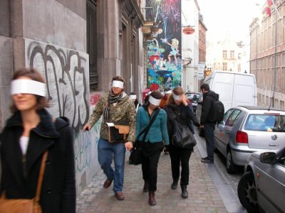
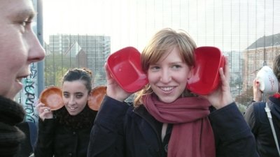
This project was the occasion to make a first software prototype, using the Tresor’s toolbox, to record the meanderings of people in the city.
Here follows a series of notes explaining the first steps of the project.
The scenario goes like this. We select a series of spots in Brussels. These spots correspond to the postboxes spread in the center of the city. Their locations cover a wide range of places and environments, you can find them near schools, streets with heavy traffic, dead end streets, parks, etc.
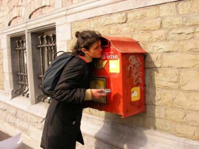
A group of people go in the city with an audio recorder and a GPS and visit the spots. The clocks of the GPS and the recorders are synchronised. The GPS records all the time the tracklogs of the people and the audio device capture the sound for the whole duration of the walk. When they come back after the walk, the GPS data and the audio data are copied on a computer. By comparing the time code of the GPS track and the start time of the audio track, we can extract audio segments based on location. we can extract the audio recorded by the walkers when they were nearby the spots.
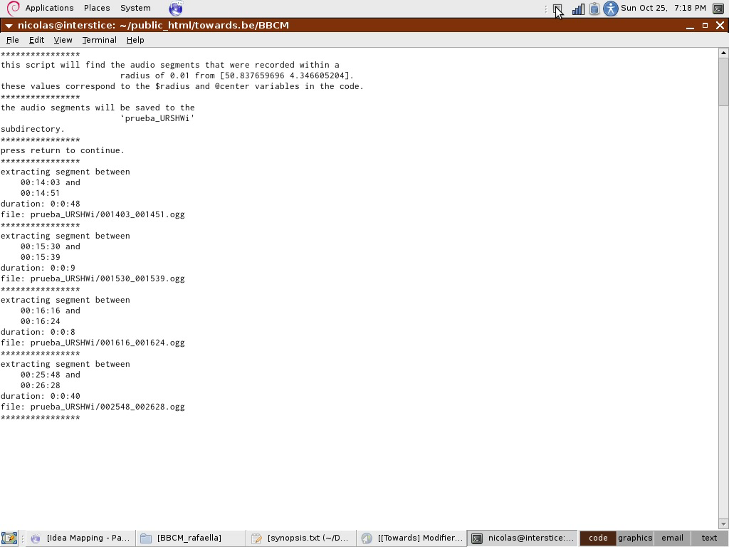
These audio segments can then be placed on a digital map where the visitors can listen to them. The interface allow them listen to the chaos of all the sounds they have recorded near the spots or to select the sounds one by one, turn them on and off.
Samples:
Some walks have concentrated on the atmospheric sound, recording the ambient atmosphere( ie. pool_atmosphere_long.ogg), or interacting with it (scratching the surface with shoes ie. scratching_the_ground.ogg).
Other guides gave instructions like describing aloud what one was seeing (STE-003-workingcopy_00m_43s_40h__01m_25s_90h.mp3, STE-003-workingcopy_35m_43s__38m_59s_40h.mp3, STE-003-workingcopy_09m_01s_80h__10m_37s_60h.mp3, STE-003-workingcopy_51m_30s__55m_28s_60h.mp3,STE-003-workingcopy_15m_55s_50h__19m_37s.mp3,STE-003-workingcopy_23m_17s_40h__27m_52s_90h.mp3)
Etc etc.
Interface:
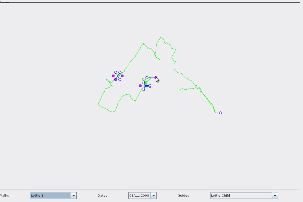
By default, the software lets you listen to the ’mumbling’(all_walk-5.ogg,all_walk-0.ogg) of the whole last walk, or to select individual takes within this.
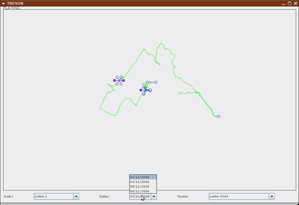
Using the menu, you can chose a walk or chose a date or a guide.
Software in use:
openstreetmap, setting the coordinates
gpsbabel, can extract data from a gps unit. can also select data by region and time
sox, given a start time, it can cut audio fragments for a certain duration
mp3splt, cuts an mp3 file in segments
gstreamer allows for playing audio files concurrently
perl, php and java to glue the elements.
The software prototype has been developed by Ivan Monroy Lopez and Nicolas Maleve. The pre-alpha soon available for download.
Carte très très subjective...
2009-06-18 13:49:23 - by
Antoine Berlon
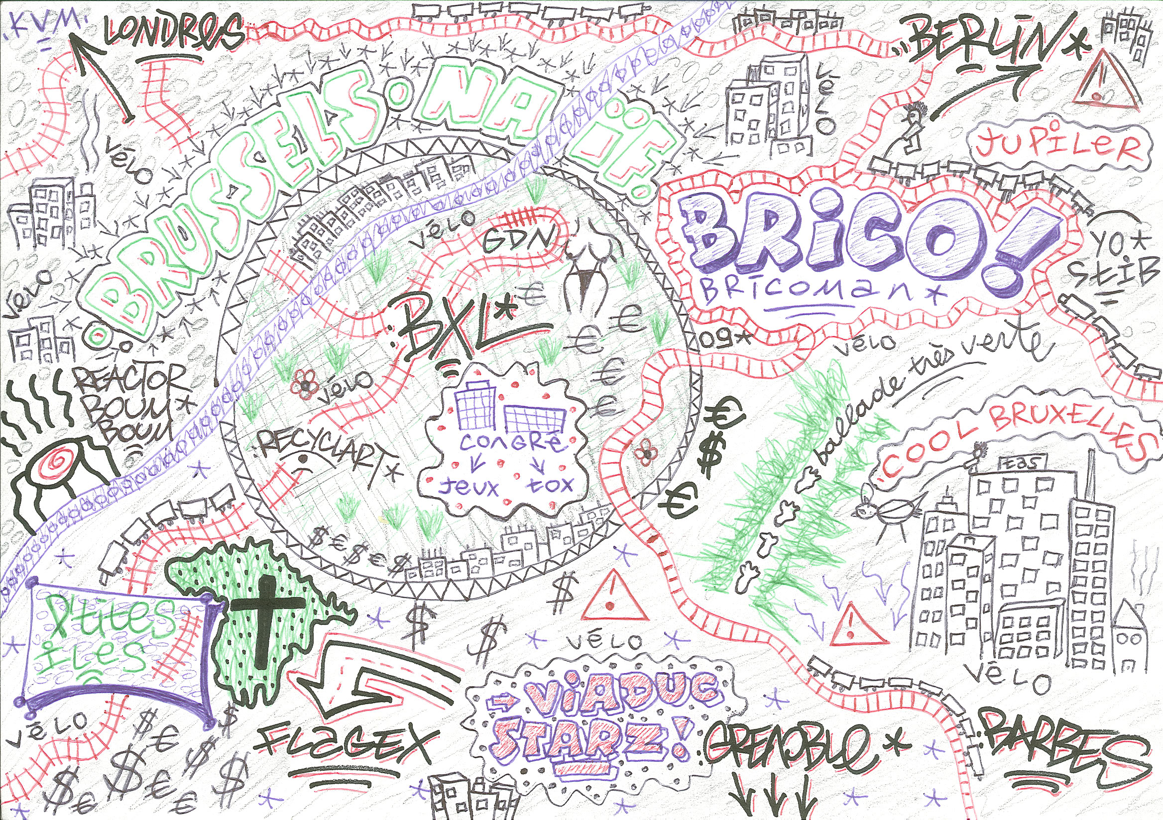
Cette carte a été réalisé par un jeune de passage de quelques semaines à Bruxelles. Elle relate les parcours de ville réalisés à pieds, en vélo, en voiture et en train allant d’Est en Ouest, du Nord au Sud. Et voila ce qu’il nous propose : des voies de chemin de fer ressemblant à des serpents interminables, un réacteur électrique peu reconnaissable, et une rue du Viaduc (Ixelles) disproportionnée. Le tout apparait comme un dessin d’enfant contenant en lui beaucoup de naïveté.
"Carte très très subjective" puisque beaucoup d’éléments semblent peu compréhensibles et difficilement lisibles cartographiquement parlant.
"L’OPÉRA" arrive en ville !!!
2009-06-16 09:55:38 - by
Antoine Berlon
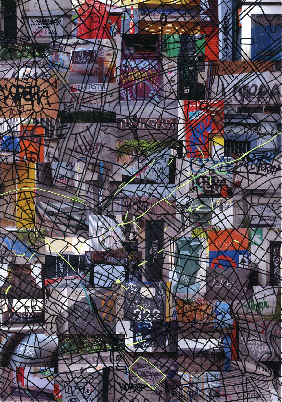
Cette carte a été réalisée par Rébecca Fruitman lors d’un travail de fin d’année pour l’académie des beaux arts. Résultat d’une investigation quant à l’identification de l’auteur de ce tag, une étude comparative a été effectuée au niveau des couleurs, des supports, des matériaux, du graphisme et des lieux. Le projet donne une visualisation du terrain d’action du taggeur repérable par sa signature "L’OPÉRA" (antérieurement par anagramme "PAROLE"). Ce taggeur utilise des matériaux différents et inscrit dans l’espace public de nombreuses signatures qui empruntent des techniques au graffiti ainsi qu’a la calligraphie.
Wandelen naar Kongo
2008-03-27 19:06:26 - by
Rafaella Houlstan-Hasaerts
Lucas Catherine, 2006.
La Belgique, ce n’est pas seulement les bières et le chocolat, c’est aussi le Congo. Léopold II était-il le premier et le dernier urbaniste de Bruxelles ? S’éloignant des clichés touristiques et suivant les traces d’un héritage colonial contesté, Lucas Catherine a organisé et cartographié de nombreuses balades dans Bruxelles. Des grands projets urbains aux bâtiments financés par l’argent de la colonie, en passant par les statues et les rues qui célèbrent la gloire des colons, Lucas Catherine se sert de la découverte de l’architecture comme moyen d’aborder une histoire sanglante et méconnue.
Voir : Lucas Catherine, Wandelen naar Kongo ; Editions EPO, Bruxelles, 2006.
