


TOWARDS : to carry out of an atlas of Brussels taking up various maps: real, imaginary, artistic, anecdotal, psychological, geographic, town planning, amateur, professional, regional, local, etc
Drawing maps. Several of us take an interest in it, be it to develop plans for the city, to put memories together, to assert a political, social, cultural or economical position or to file projects… The truth is, there are as many possibilities to map out the territory of Brussels as there are cartographers who enter into the spirit of the game: one will inventory the places that are equipped with surveillance cameras, the other will note down different skateboard spots, yet another one will map out the way users seize the public space… Strollers “annotate” the streets with their current thoughts and sensations. An occasional visitor builds an imaginary landscape of Brussels according to the places she visited during her stay and to the links that made her go from one to another… British bureaucrats design mental maps that schematise their view of the city… When the most conventional reduce the material space to its bidimensional representation, others try to “give back substance” to this abstract spatiality by adding to it customary, imaginary, mental, anecdotal or metaphorical referents. The boldest even go up to becoming liberated from the spatial standards so as to formalize personal experiences…
With the passing weeks, months, years, new faces of Brussels would see the light of day and a new form of memory would take shape: the memory of urban struggles, of unofficial interventions, of association positivism, of the richness of the actors of Brussels…
The memory of a new vision, far from tourist clichés and community negotiation. Such is the interest of developing advisory and collaborative instruments of subjective cartography: comparing those various faces of Brussels with the more official or statutory maps that divide the capital of today, confronting them to the latter or including them to it.
Question of classification: In order to develop an atlas of Brussels, which standards must be set up to classify in a relevant way those maps of heterogeneous kinds? Besides, if the aim is to display the plurality of cartographical approaches, is it truly necessary to set up such standards?
Biomapping_Emotional maps of Brussels
Christian Nold, march 2006.
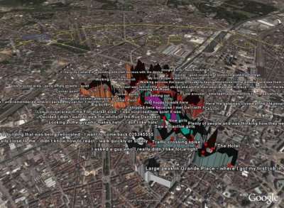
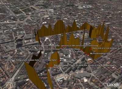

Bio Mapping is a community mapping project in which over the last three years almost 1000 people have taken part in. Instead of security technologies that are designed to control our behavior, this project envisages new tools that allows people to selectively share and interpret their own biometric data. In the context of BXL Bravo, participants were wired up with an innovative device which records the wearer’s Galvanic Skin Response (GSR), which is a simple indicator of the emotional arousal in conjunction with their geographical location. People have re-explore the Brussels city center by walking the neighborhood with the device and on their return a map was created which visualizes points of high and low arousal. By interpreting and annotating this data, a communal emotion maps were constructed that were packed full of personal observations which show the areas that people feel strongly about and truly visualize the social space of a community.
See: www.biomapping.net
The data available here allows you to create your own spatial visualisations of the Bio Mapping data collected by hundreds of participants. And is available under the Creative Commons Attribution NonCommercial ShareAlike 2.5 License.
Françoise Schein, 1992
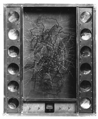
Steel, wood, aluminium, objects, newspapers, lights (70x90x25cm). Private collection. Reproduction courtesy of the artist.
See also: Marie-Ange Brayer, Le Planétarium urbain de Françoise Schein in +/0 (revue bimestrielle d’art contemporain), n° 51, october 1988.
Bruxelles, Ville d’ouvertures: Cartography of exhibition places in Brussels
Alain géronneZ, 197?-2001.
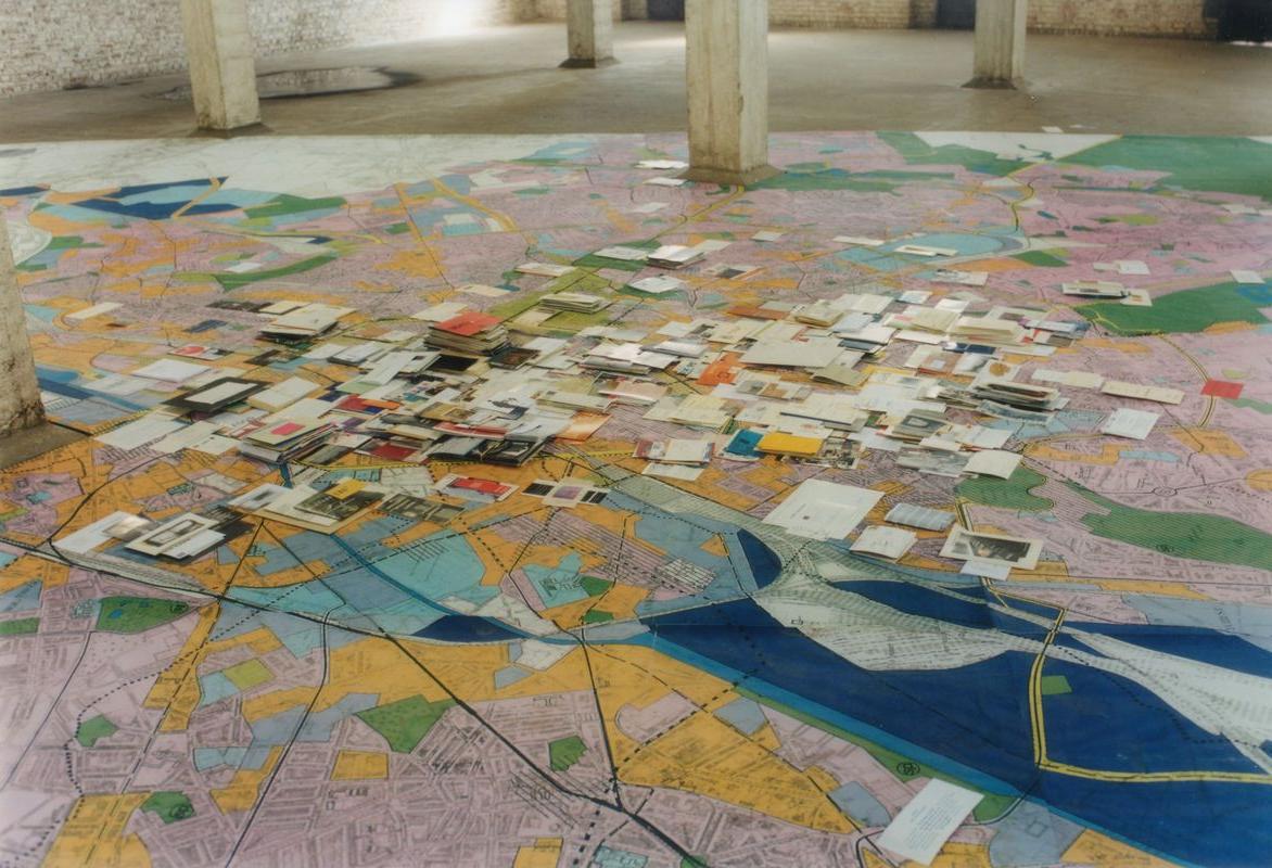
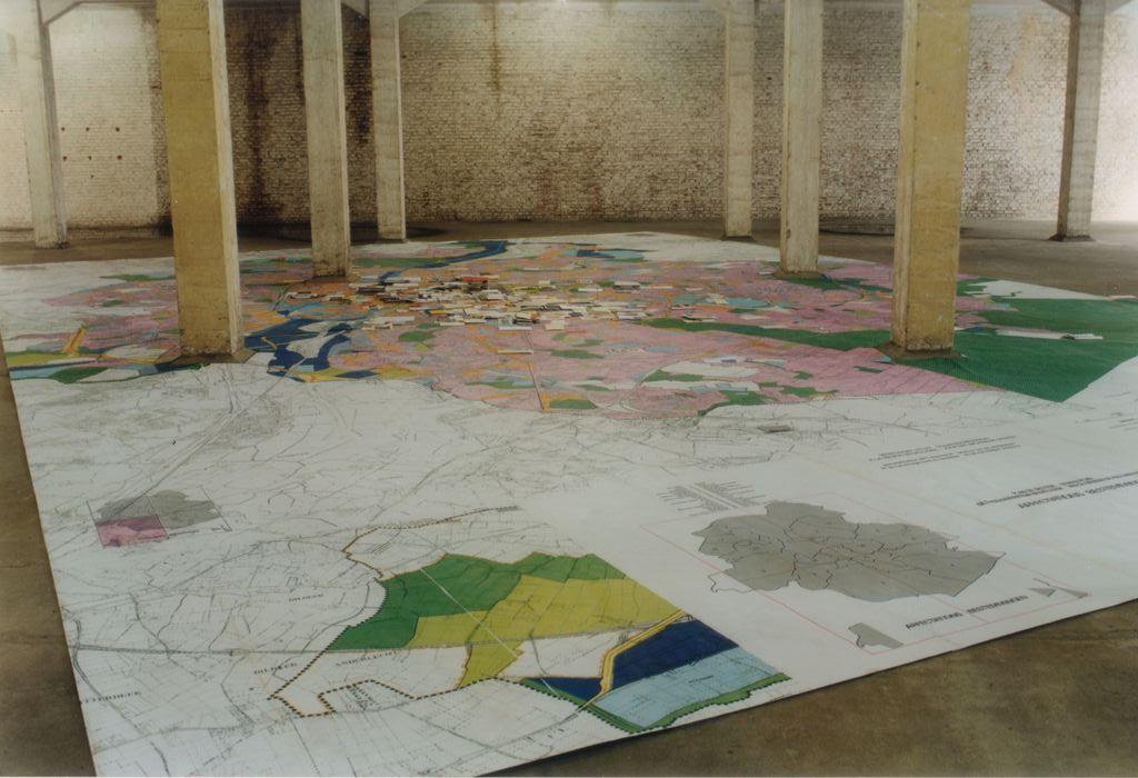
This map carried out within the framework of the exhibition «Ici et Maintenant» at Tour et Taxis (2001-2001) inventories and illustrates various exhibitions that have taken place in Brussels, by means of flyers and brochures.
Rival, 1996-2006.
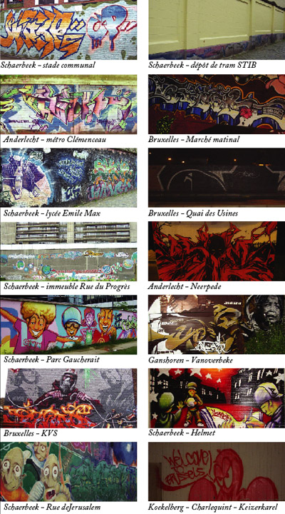
Within the framework of an exhibition in Recyclart, Rival mapped out some of the most interesting grafs in Brussels. He focused mostly on Schaerbeek and launched a parallel gathering of informations. From then on, his goal is to realize some kind of evolutive guide of legal or illegal grafs, still visible or already covered/faded.
Laureline Deloingce, 2007.
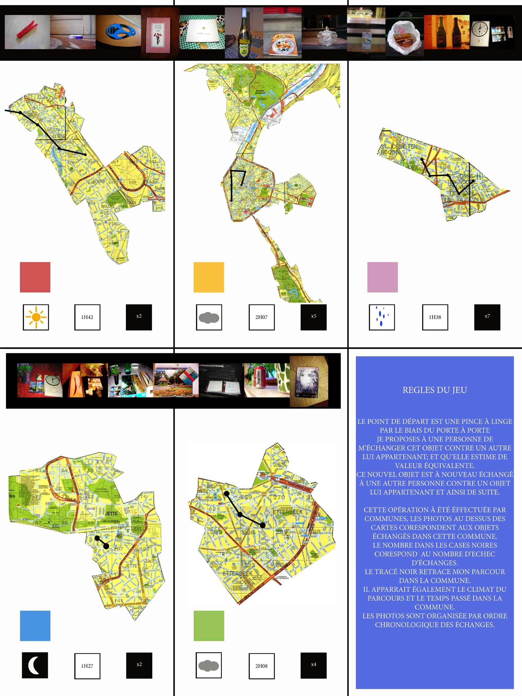
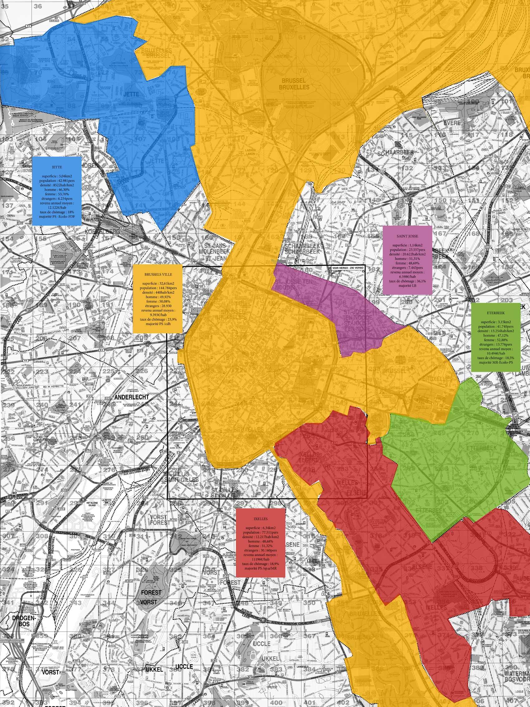
See also: www.propaga.org/Laureline
Cartography of the concert halls which marked Brussels
Harrisson et Benoît Deuxant, 1995-2005.
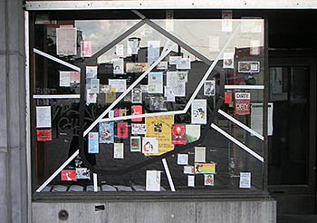
Within the framework of the first towards exhibition in Recyclart, Harrisson and Benoît Deuxant pointed the musical halls which have marked Brussels during the last ten years. Which were they? Which associations, collectives or people created them? Which was their respective impact? The cartography of Harrisson and Deuxant brought to light the birth, the evolution, the changes or the death of a series of underground concert halls. They based it on an (inter)subjective approach by gathering the memories, the impressions and the intuitions of several persons. At the same time, they have started a collection of the flyers, posters and brochures that announced the events that were once programmed in those places.
Cartography of urban interventions in public spaces
Kathleen Mertens, 1999-2005.
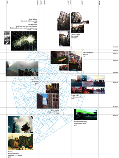
Within the framework of the first towards exhibition in Recyclart, Kathleen Mertens (re)read Brussels in the light of a series of interventions which, at least, have transformed the perception of the public space where they took place. More broadly speaking, they can point the potentialities of the space or serve as a catalyst for neighborhood interactions. This reading was made without any attempt of exhaustiveness: in fact, Kathleen takes back some fragments of her personal background, be it that she was involved in the project or simple spectator.
Collaborative game of the real estate speculation in Brussels
Rotor, 2004.
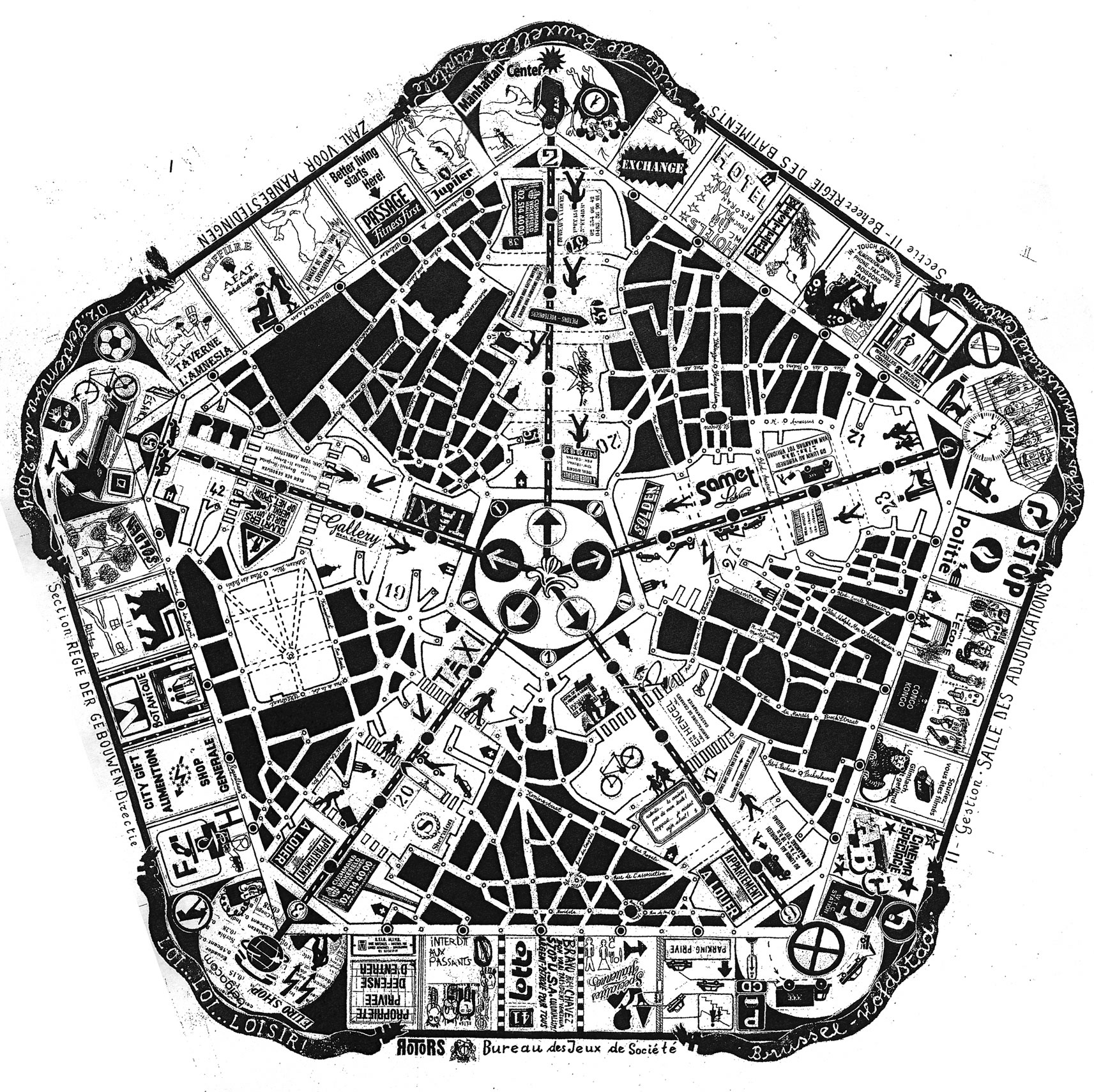
Inspired by citizen tactics and urban struggles, Rotor worked out a collaborative game which allows the experimentation and the trial of strategies and actions which can be put into practice in the real world. By taking Brussels as a starting point, this game brings two teams face to face: the speculators and the citizens. The speculators attempts to impose their rules (the laws) and have the possibility to change them during the game, whereas the citizens are forced to follow the rules as they try to set up strategies to subvert them. The game board can be purchased for free on the Rotor’s Website (www.rotorrr.org).
Illustrated spatiotemporal inventory of Bruxel
Nathalie Mertens, ?-2006.
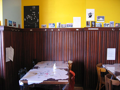
Within the framework of the first towards exhibition in Recyclart, Nathalie Mertens organized a series of meetings with some Brussels’ cultural actors. During each meeting, the participants have carried out three different maps: a first one about “positive” interventions realized in the public space, the second one about the immaterial and emotional value of Brussels and the third one about unrealized projects and ideas.
Imaginary landscape of Brussels
Bettina Wind (D), 18/02/2004.
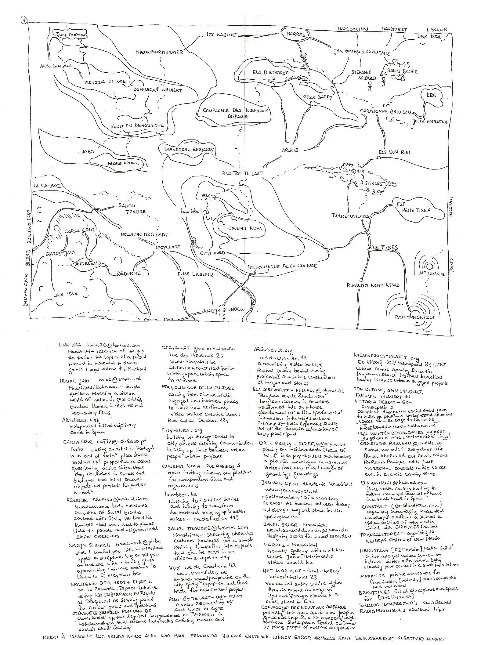
Maps of the various collectives, associations and places visited by Bettina during her stay in Brussels (2004) and of the links that led her from one to the other. The lower part of the maps takes up the various actors that she met so as their description and/or contact.
Imagining the Brussels’ Northquarter in 2050
Kobe Lootens, 2006.

Kobe Lootens works out an utopian map for the Brussels Northquarter. His project intends to take advantage of the dramaturgical potential of the Manhattan quarter by intensifying the height of the existing towers and tries to solve the problem of mono-functionality by placing new programs in those office buildings (horeca, public areas, housing). He pays special attention to the public space and to the aquatic element (as landscape potential and sustainable energy producer). A “green” structure is dedicated to bicycles and pedestrians and links the Northquarter with the Channel, Tour et Taxis and the Maximilian Park.
See also: www.bxln2050.be
Integrated cities: Brussels Crispy
Françoise Schein, 1984.
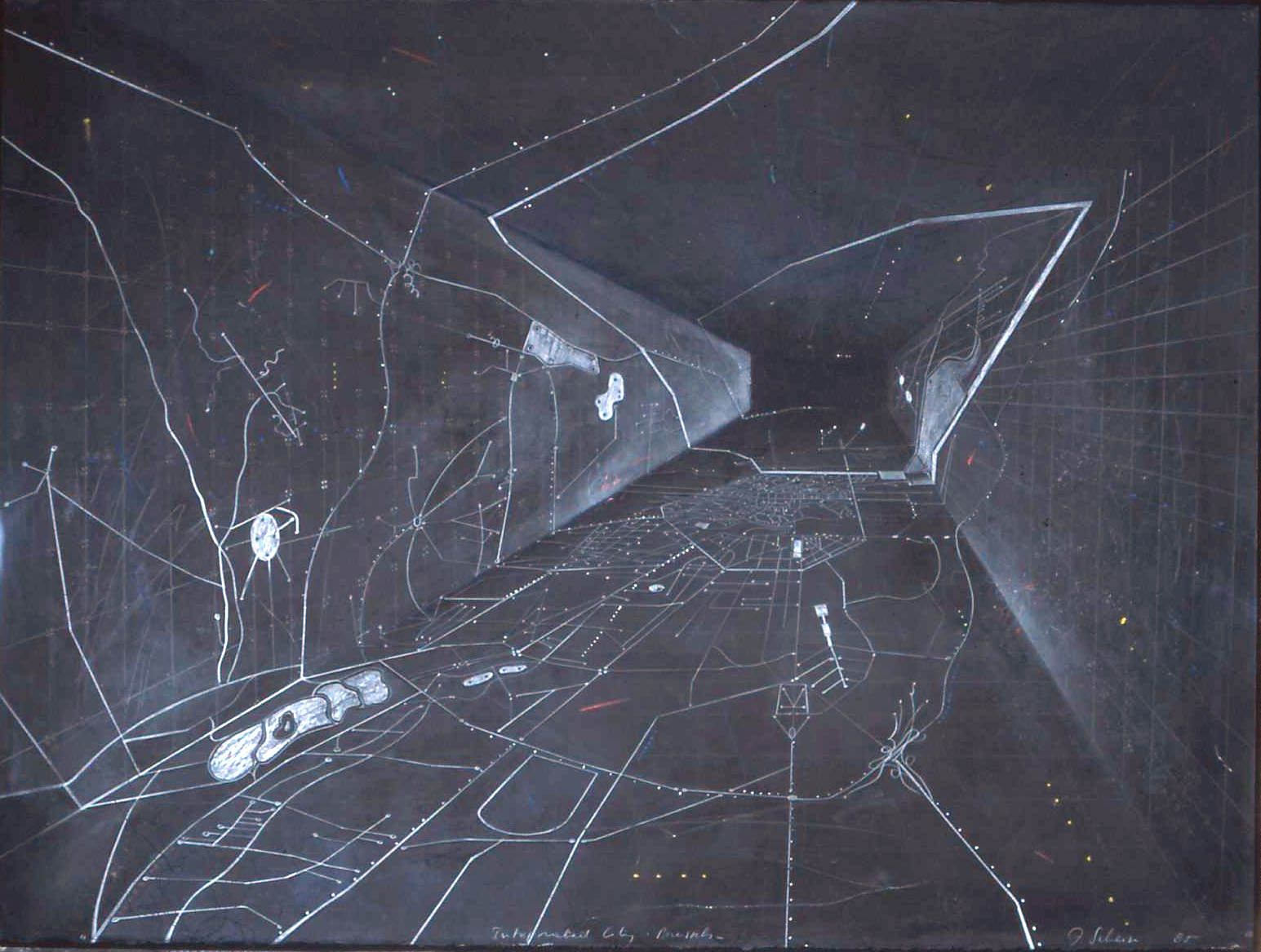
Pastel drawing (76x 57cm). Private collection. Reproduction courtesy of the artist.
Map base under free licence created for the «Réseau citoyen»
David Kowalkowski, 2001.
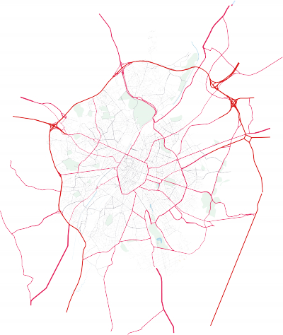
David Kowalkowski takes the opposite position to the maps subject to copyright and proposes a free map base of Brussels in a vector file format, created from various aerial photographs and maps.
Download the vector file in svg format (Ctrl-click and "Save as..." if needed)
See also: www.reseaucitoyen.be
Map of the interviews carried out within the framework of the "Babeleer" project
Bruxelles nous appartient, Brussel behoort ons toe, 2000-2007.
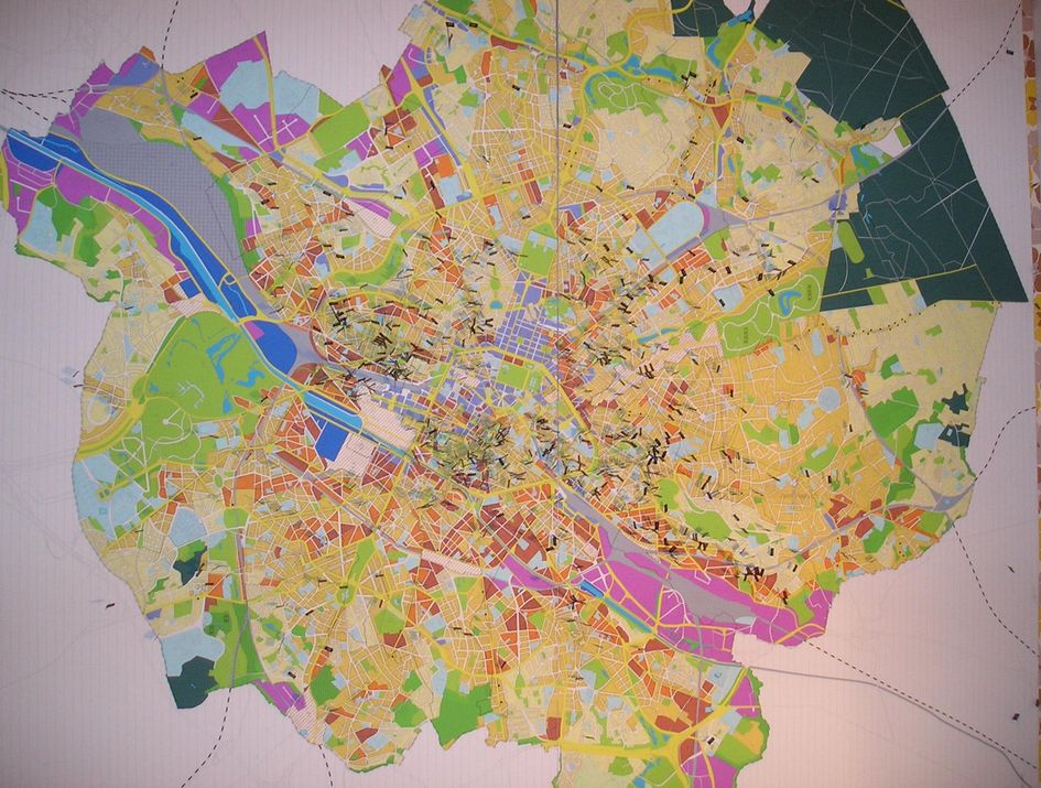
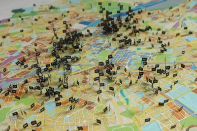
The aim of this project is to gather the words of some inhabitants of Brussels, who are invited to express themselves about their everyday life and their perception of the city. Those interviews, which are related to the imagination, the dreams and the points of view of the people, can be used within the framework of artistic, sociologic, ... projects.
See also: www.bna-bbot.be
Map of the squats and of the pockets of gentryfication in Brussels
Alice Romainville, based on a study of Mathieu Van Criekingen, 1993-2006.
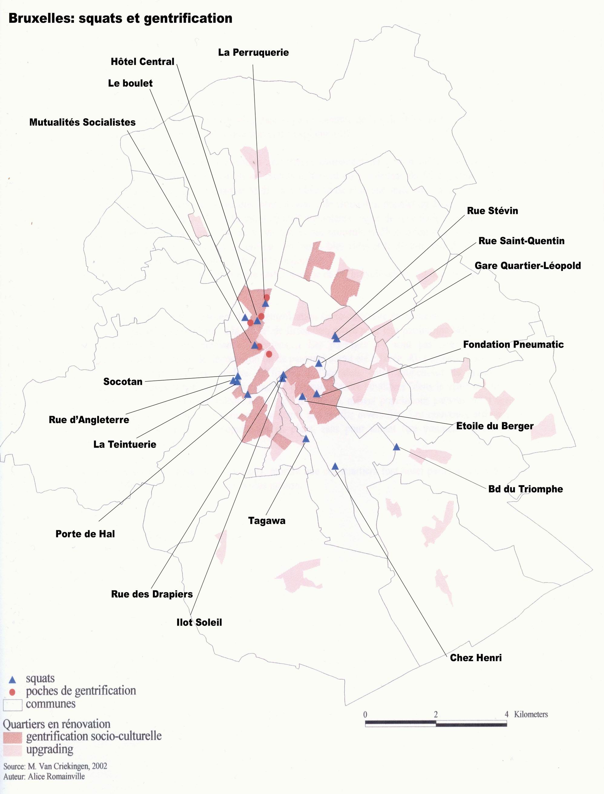

Realized within the framework of a Master in geography, this map inventories the open squats and the pockets of gentrification in Brussels.
Tiziano Lavoratornovi, 2006.
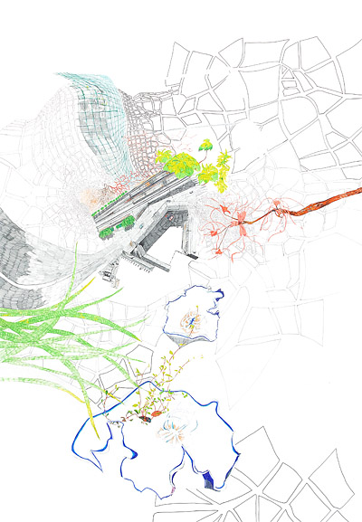
Within the framework of the first towards exhibition in Recyclart, Tiziano Lavoratornovi represented -by means of a series of subjective codes- the numerous links between various places, collectives and cultural associations that he knows. Throughout the prism of his experiences, his data relate the story, the connections or the interdependences between those different actors/activists.
Made by students from Sint Lucas (school of architecture), 2006.

Powerpoint allowed on demand: veronique@citymined.org
Anonymous (an initiative of the OpenStreetMap foundation)
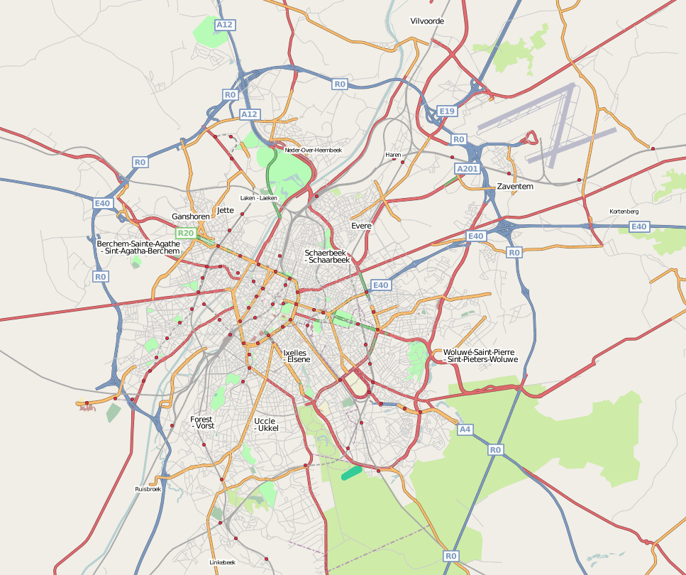
The OpenStreetMap Foundation is an international non-profit organization dedicated to encouraging the growth, development and distribution of free geospatial data and to providing geospatial data for anybody to use and share. The project was started because most maps we think of as free actually have legal or technical restrictions on their use, holding back people from using them in creative, productive or unexpected ways. In order to contribute to the OpenStreetMap project, participants take their GPS device on their journeys or go off on organized GPS tracing events. They register names of streets and villages and all other characteristics using a pen and paper, a photo device or dictaphone. Back behind their computers, they upload their GPS traces they made during their trip and trust their routes to the collaborative database of OpenStreetMap. Using their notes, the contributors add streetnames and info about the type of route or path and connections. The data is then treated to produce detailed maps, which can be published on sites such as Wikipedia, which can be used to create portable, embedded, printed navigation systems which can be copied without limits.
Schuman City: Mental maps of British bureaucrats
Jullie Caillez, 2002.
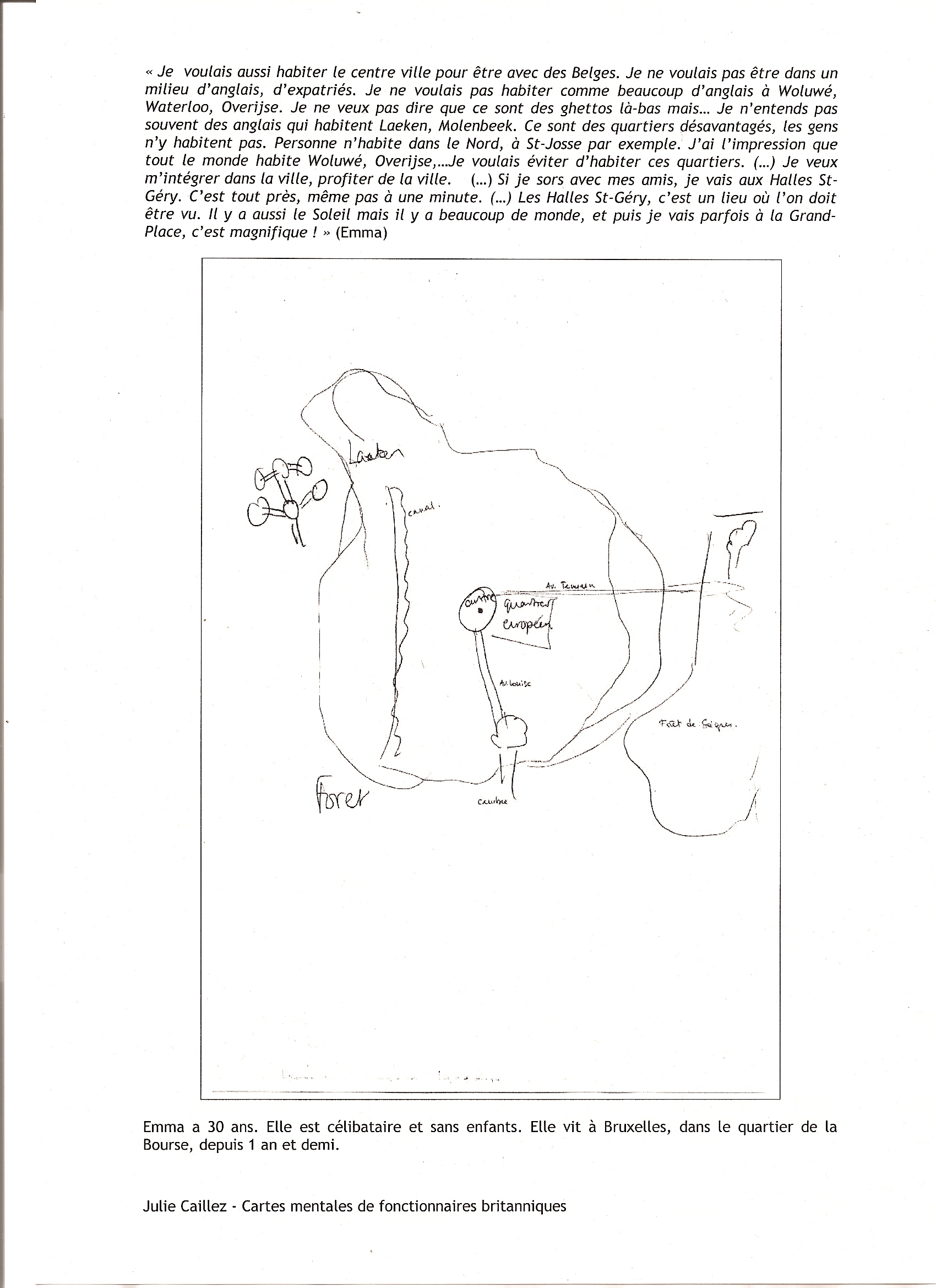
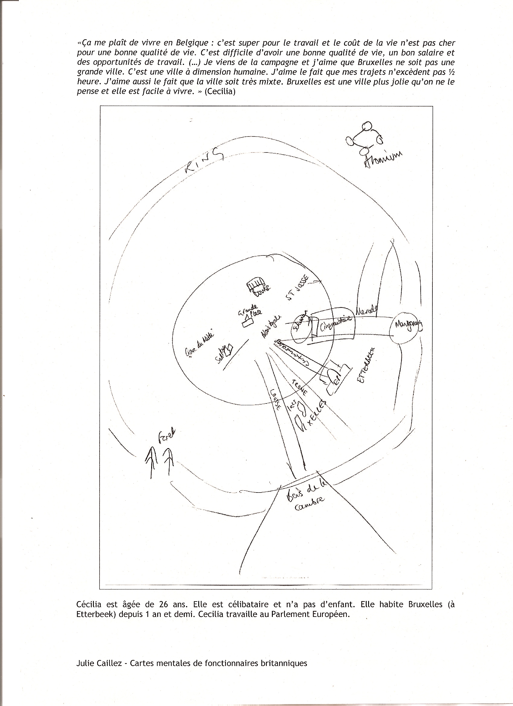
Within the framework of a sociologic research study concerning British bureaucrats socio-spatial appropriation of Brussels, Julie Caillez took an interest in the way those foreigners use and structure the urban space, construct a mental image of Brussels and find their bearings in the city. To that end, she asked twenty British bureaucrats to carry out mental maps that takes out the structuring elements of their perception of the city. The access to the data and their use are allowed on demand. The author must be mentioned under any circumstances.
See also: Julie Caillez, Schuman City, Des fonctionnaires britanniques à Bruxelles, Ed. Bruylandt-Aca-demia, 2004.
Collin Hotermans, april 2006.

In a more or less formal way, skaters of all genres have been taking possession of several public spaces in Brussels. Initially addressed to board lovers, this map inventories various skateboard spots in Brussels, as well as the sliding and figures potentialities of those places.
See also: www.brusk.be
Surveillance cameras in Brussels
Alice Romainville, based on a study of J.Unger (2002) and on an article appeared in the Vlan (16/02/2005), 2005.
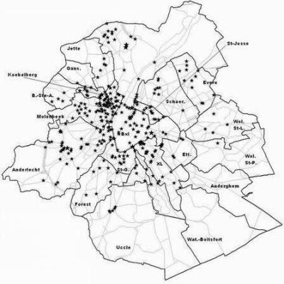
In Brussels, public ways have been increasingly supervised by authorities and for years, the presence of video surveillance systems has been in continuous growth, especially in the city center. In order to reveal the magnitude (extent) of this phenomenon, this map inventories most of the surveillance cameras present in public space.
See also: this map appears as an illustration in the article "Souriez, vous êtes filmés!" in C4.
With the same topic: Map of Brussel surveillance cameras by Constant
Sabine Guisse, april-may 2007.

Within the framework of the program « Prospective Research for Brussels », Sabine Guisse wonders about the necessity of redefining the goals of urban intervention in public space, by basing it on the multiplicity of uses. During her research study, she developed a cartography of how people use Brussels public space. To that end, she imagined a tool similar to the geographic transect, which is a continuous ambling along in which one records and counts occurrences of the phenomenon of study. Her observations covered a significant part of the regional territory, from the South- East to the North-West, trough the city center. This path was chosen in order to explore a sample of the territory in which social and spatial diversity is obvious. All the visible interactions between people and public space were photographed, as well as the spatial configurations of the visited places.
Therefore, the transect reveals the diversity of the situations on a regional scale and allows to identify local tendencies and to bring out the variations (contrasts, progressions, recurrences) in the public spaces appropriation modes. This practical method goes against scientific and political practices, which often neglect some situations (emerging, complex) that can prove pertinent when it comes to urban intervention.
Urban struggles and space conquests
Syndicat d’initiatives, 1966-2006.
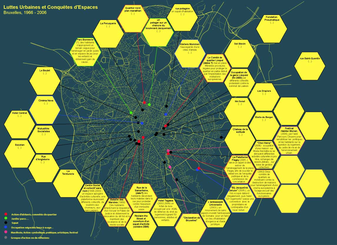
This map inventories various urban struggles in Brussels: it is a gathering of stories of local resistances, of recipes and tactics set up by citizens, collectives and associations in order to fight against urban planning projects or real estate speculations that jeopardize singular urban environments. To carry out this map, Syndicat d’initiatives has paid close attention to the creativity of the resistance forms set up by those space users.
Nedjma Hadj, 2006.
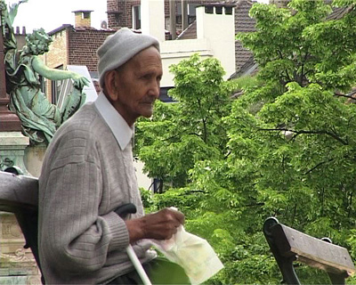
Nedjma Hadj takes an interest in urbanity. Within the framework of the first towards exhibition in Recyclart, she attempted to redefine this notion by means of the look and the use of some inhabitants of Brussels. The “map” of Nedjma is the result of an assemblage of various filmed places and of the interviews of some inhabitants of Brussels met during this project.

